L’Agout – St Paul Cap de Joux
St Paul Cap de Joux France
SIZE
17 km
SWIMS
-
ANGLERS
-
STOCK
Good
CARP
45lb +
DIFFICULTY
4/5
LAKE MAP
No
NIGHT FISHING
Yes
L’Agout – St Paul Cap de Joux
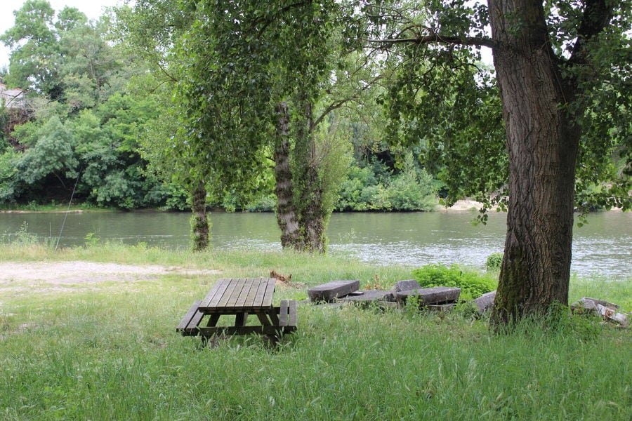
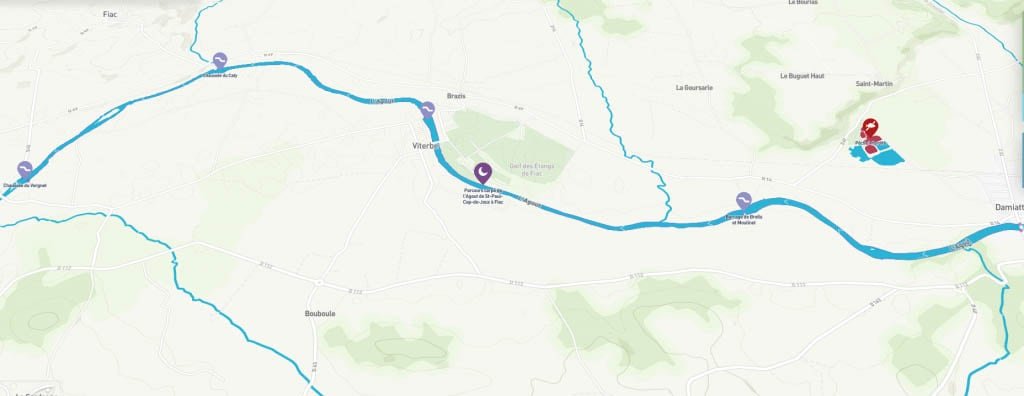
The Agout - St Paul Cap de Joux - is a river in the south of France, in the two departments of Hérault and Tarn (81), in the Occitanie region. It is an important left tributary of the Tarn, therefore a sub-tributary of the Garonne. It takes its source at 1,100 meters above sea level in the Haut-Languedoc Regional Natural Park near the summit of Espinouse in the Espinouse mountains in Haut-Languedoc and flows into the Tarn at Saint-Sulpice-la-Pointe , in the Tarn department, at an altitude of 94 meters. Winding down between mountains and valleys, with a course of 196 kilometers, the Agout is an abundant river which gives rise to an important diversity of landscapes, agricultural cultures, traditional habitats and picturesque places. This river has a very large fish diversity in white fish (gudgeon, roach bleak, barbel, minnow), predators (with the presence of beautiful perch and pike) and cyprinids such as common carp. You can also flush out brown trout and, more rarely, lampreys. This abundance of fish and its varied landscapes have led for many years to a high attendance of enthusiasts throughout the fishing season and nature lovers.
Facilities
- Bait Available
- Tackle Hire
- Expert Guide
- Bait Boats
- Rowing Boats
- Lockbox
- Disabled Access
- -
- -
- -
- -
- -
- -
- -
- Toilets
- Food
- Showers
- Hot Water
- BBQ
- Car Parking
- Dogs Allowed
- -
- -
- -
- -
- -
- -
- -
Specifications
Use:
Type:
Size:
Swims
Max Anglers:
Stock:
Carp Weight:
Difficulty:
Night Fishing:
Fishing
River
17 km
-
-
Good
45lb +
4/5
Yes
Rules
Fishing only with vegetable bait. Fishermen are required to signal their presence by means of a light device. Authorized but regulated navigation. Fédération Pêche Tarn.
-
Description
L’Agout – St Paul Cap de Joux
The Agout - St Paul Cap de Joux - is a river in the south of France, in the two departments of Hérault and Tarn (81), in the Occitanie region. It is an important left tributary of the Tarn, therefore a sub-tributary of the Garonne. It takes its source at 1,100 meters above sea level in the Haut-Languedoc Regional Natural Park near the summit of Espinouse in the Espinouse mountains in Haut-Languedoc and flows into the Tarn at Saint-Sulpice-la-Pointe , in the Tarn department, at an altitude of 94 meters. Winding down between mountains and valleys, with a course of 196 kilometers, the Agout is an abundant river which gives rise to an important diversity of landscapes, agricultural cultures, traditional habitats and picturesque places. This river has a very large fish diversity in white fish (gudgeon, roach bleak, barbel, minnow), predators (with the presence of beautiful perch and pike) and cyprinids such as common carp. You can also flush out brown trout and, more rarely, lampreys. This abundance of fish and its varied landscapes have led for many years to a high attendance of enthusiasts throughout the fishing season and nature lovers.
-
Facilities
- Bait Available
- Tackle Hire
- Expert Guide
- Bait Boats
- Rowing Boats
- Lockbox
- Disabled Access
- -
- -
- -
- -
- -
- -
- -
- Toilets
- Food
- Showers
- Hot Water
- BBQ
- Car Parking
- Dogs Allowed
- -
- -
- -
- -
- -
- -
- -
-
Specifications
Use:
Type:
Size:
Swims
Max Anglers:
Stock:
Carp Weight:
Difficulty:
Night Fishing:
Fishing
River
17 km
-
-
Good
45lb
4/5
Yes
-
Rules
Fishing only with vegetable bait. Fishermen are required to signal their presence by means of a light device. Authorized but regulated navigation. Fédération Pêche Tarn.
-
Lake Map
Advice for fishing in France can be found HERE.

-
Lake Video
-
Location
Advice for fishing in France can be found HERE.
GPS:
Lat 43.648899078369
Lon 1.977304100990 -
Contact
-
Live Weather


